VIDEO REPRISE: Return of the terns

July 21, 2013

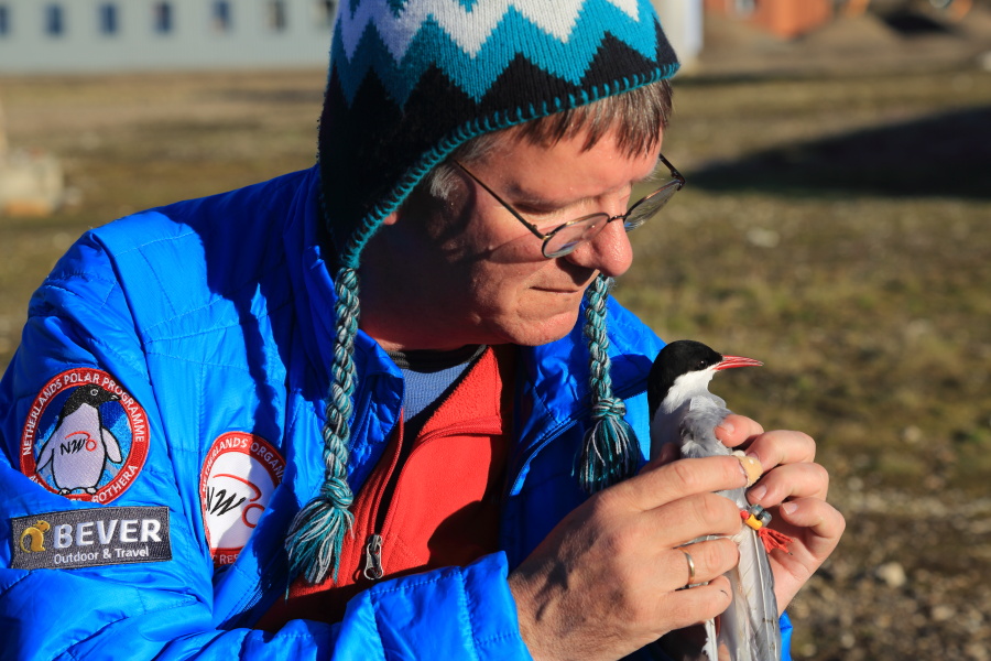
A short video takes viewers behind the scenes to see how Dutch biologists capture, measure and tag Arctic terns in Svalbard to study their amazing annual roundtrip between Antarctica and the Arctic, during which they log over 80,000 kilometers, the world’s longest bird migration. For more details, see earlier post, Return of the terns.

CLICK PHOTO TO LOG FREQUENT FLYER MILES:

6P5A5214

Dutch scientist studies Arctic tern migration. © Randall Hyman

PHOTO GALLERY: Return of the terns

July 21, 2013

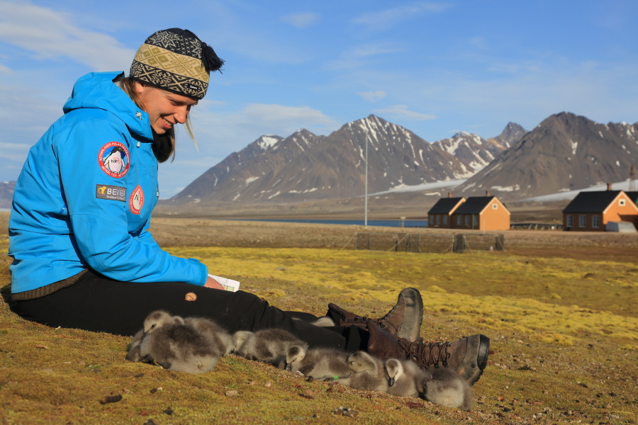
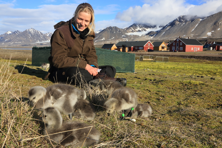
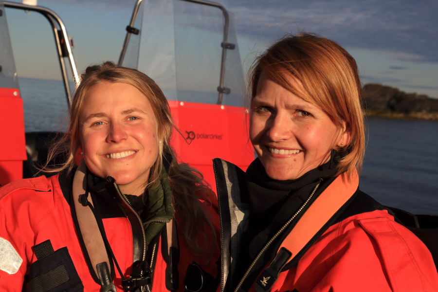
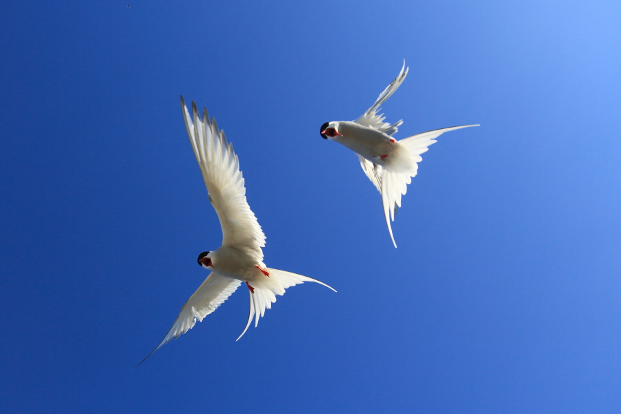
The Dutch research station at Ny-Ålesund is no fly-by-night operation, especially when it comes to Arctic terns, who literally fly to the ends of the Earth to avoid darkness.  As world record holders for long-distance migration, these terns bask in endless daylight in Antarctica, November through February, and return north when the sun dawns in the Arctic bringing summer-long continuous daytime. Like scientists on an avian treasure hunt, the Netherlands team searches the village for nesting terns, scooping them gently from their nests and retrieving ultra-light geolocator loggers from their legs to fit them with new ones. (see later post, VIDEO REPRISE: Return of the terns)

Wearing knit caps to protect themselves from the stilleto-sharp beaks and screaming dives of indignant terns, Arctic ecologist Maarten Loonen and Masters student Tim van Oosten work together capturing and tagging birds.  Loonen explains, “Our loggers show that the Svalbard population flies over 20,000 kilometers (12,500 miles) on a zig-zag route from the Weddell Sea on the Antarctic Peninsula, stopping first in West Africa, then Central America, then Greenland and finally back here. In total they fly as much as 80,000 kilometers (50,000 miles) per year. This was a surprise.”

Many terns have already bred now and fledged their young, but those who suffered egg predation from foxes or polar bears are still nesting and can actually lay up to three times a season if their eggs are taken. They depend on the fat capelin and Arctic cod in the waters surrounding Svalbard to breed and stay healthy. Despite steadily rising ocean temperatures, these fish have so far remained abundant.

“They are income breeders and come here to both feed and lay,” adds Loonen.  “Our other study species, barnacle geese (see later post Mother Goose as scientist), are capital breeders who converge in Scotland in huge flocks in spring to fatten up on grass before flying here to raise their young.”

Van Oosten’s work helps Loonen compare the health of Netherlands-nesting terns with the Svalbard population, which just begins nesting in the Arctic when Dutch terns are ready to fly south. The timing of upwelling ocean currents that produce good fishing along the migration route may be critical.

“The number of terns nesting here this year is one third of previous years,” says Loonen.  “I’ve noticed their tail feathers are worn and dirty, which could mean they had some trouble feeding during migration and arrived here in poor condition.”

Meanwhile, some terns have already begun gathering on islands surrounding Ny-Ålesund to prepare for their long flight back to Antarctica in August.  Loonen and Van Oosten wish them many happy re-terns.

CLICK PHOTO WHEN IT’S YOUR TERN:

6P5A5085

Arctic terns return from Antarctica. © Randall Hyman

VIDEO: Glacier spectacular… breaking the ice

July 14, 2013

There are times when nature’s forces overwhelm and leave one viscerally stunned, struggling to fully comprehend what just occurred. Watching a glacier calve huge blocks of ice into the sea is not usually in that category. It is exciting, to be sure, but not terrifying.

On the very rare occasion, though, that one happens to be half a kilometer directly in front of a towering glacier that suddenly erupts with a deafening roar and collapses in a succession of thunderclaps in all directions, climaxing with the entire height of one section keeling forward in an explosion of spinning ice projectiles and airborne ocean, the experience definitely qualifies as both heart-thumping-thrilling and terrifying… especially when when one realizes that there is a tsunami wave headed for your boat after four endless minutes of domino-like calving.

It is perhaps understandable if snapping pictures takes a back seat to thoughts of survival at times like these, but it is the memory of a lifetime and worth sharing with others as a reminder of our smallness as well as our role in global warming and the steady disappearance of magnificent, awe-inspiring glaciers worldwide.

CLICK PHOTO FOR TIME-LAPSE VIDEO OF CALVING GLACIER:

IMG_9541

Huge section of glacier crashes into ocean in Svalbard. © Randall Hyman

VIDEO: Taking a break on an iceberg

July 11, 2013

Reporting on climate change in the Arctic is serious business, but sometimes you just gotta have fun and relax a bit. Getting marooned on an iceberg in the middle of the Barents Sea is a good start. (Photo of me courtesy of Norwegian Coast Guard officer Kenneth Mula)

CLICK PHOTO TO HOP ON AN ICEBERG:

DPP_0320

Randall Hyman sits on an iceberg at midnight in the Arctic Ocean. © Kenneth Mula


PHOTO GALLERY: When bird scientists bear all

July 8, 2013

Everyone wants to see a polar bear when they come to the Arctic. It’s only natural, and great bragging rights. They are magnificent creatures, an ursine version of the Terminator, practically unstoppable, even with bullets, and they find humans just as tasty as a seal meal.

While it’s thrilling seeing one, polar bears are a mixed blessing if you’re studying ground-nesting birds. “I’m Homeland Security, and home is Storholmen Island,” says Børge Moe, research biologist from the Norwegian Institute for Nature Research (NINA). He and evolutionary biologist Sveinn Are Hanssen, also of NINA (see related posting, Tromsø: City life, ducks and geopolitics), have been coming to Svalbard for years studying eiders and skuas, but recent trends have made them as much polar bear specialists as bird scientists.

“There didn’t used to be many bears in the area, but now we have to really watch out,” says Moe. “Today was great. We got to see one on a nearby island and then do our work on Storholmen. That gave us thirty minutes for sure before he could swim the two kilometers to get to us.” (To view a video about their work, see VIDEO REPRISE: Seeking the Arctic skua)

Working with them for four hours on the island, I find his calculation slim consolation, but Arctic scientists count risks differently than New York bankers. Swapping binoculars and a single rifle, Hansen, Moe and Masters student Elise Skottene keep a watchful eye for the bear while checking nests, counting eggs and snaring birds the length of Storholmen.

In the end, it is a great day, with photos of a bearded seal on ice, an Arctic skua perched on a small berg, a polar bear peering over a ridge, and lots of birds snared, fitted with electronic loggers and sampled for toxins in their blood. On the down side, eiders have abandoned all nests on the tip of Storholmen where the team saw the bear swim ashore two days earlier.

“We’ve been talking with our colleagues who work elsewhere on Spitsbergen and we’ve all seen dramatic increases in polar bear predation on eggs and chicks over the past 20 years,” says Moe.

With less ice, more summer bears get left behind on Svalbard hunting for food on land instead of seals at sea. The data Moe has compiled on the topic is stunning and compelling, but more about that in an upcoming article.

CLICK PHOTO TO JOIN THE TEAM (viewer bears all risks):


IMG_5291a

Emaciated polar bear hunts for food on Svalbard isle in summer, marooned by vanishing sea ice. © Randall Hyman

PHOTO GALLERY: Ny-Ålesund, with Arctic science for all

July 8, 2013

Three months after visiting in the grips of winter, I am back in Ny-Ålesund (Svalbard) in the High North above the 78th latitude. The landscape has dramatically changed since mid April — see earlier posting, It takes a village (aka science base) —  when a silky sheet stretched across Spitsbergen Island, covering glaciers and mountains in seamless white undulations. From the air, the island is now an abstract collage of black and white. Jagged crevasses slice across glaciers like bony ribs on a hungry animal as the relentless sun melts away winter fat and crystalline blue melt waters fill the gaps.  Rivers pour from beneath glaciers and from mountain valleys, pumping clouds of ocher and gray silt into the fjords.

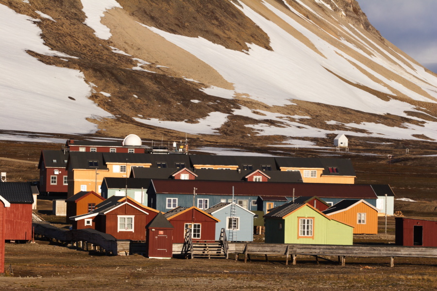
Ny-Ålesund itself is only recognizable because the buildings are the same, but what was ice and snow in April is now green mosses and gray rock teeming with barnacle geese, arctic terns,  phalaropes, buntings, wagtails and sandpipers.  Once a coal mining town, Ny-Ålesund is now both science base and history museum, with all original buildings protected as cultural landmarks. Over a dozen nations maintain research stations in these buildings, many of them countries that would have no access to Arctic research were they not signatories of the Svalbard Treaty, which grants equal land and sea rights to all treaty members.

CLICK BELOW TO SEE THE VILLAGE AND RESEARCH IN SUMMER:

30305-00102

Stark landscape emerges as snow melts around the Ny-Ålesund science base in Svalbard, Norway. © Randall Hyman


VIDEO REPRISE: Seeking the Arctic skua

July 8, 2013

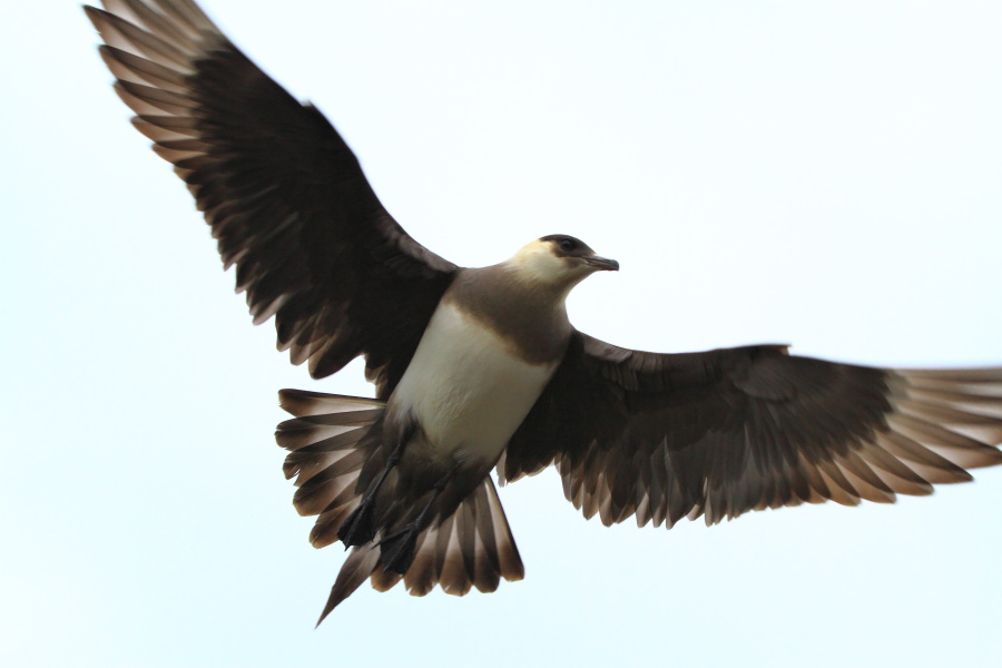
This short video tags along with biologists, Sveinn Are Hanssen, Elise Skottene and Børge Moe, who capture Arctic skuas to fit them with GPS loggers and track their migration. Their study has revealed surprising new data indicating that skuas from Norway’s Svalbard archipelago do not all migrate to the same destination. Some spend the winter in the Mediterranean while others fly all the way to South America’s southeast coast. (For more on their work, see When bird scientists bear all)

CLICK PHOTO TO VIEW VIDEO:

IMG_9076

Arctic skua in Svalbard, Norway. © Randall Hyman


PHOTO GALLERY: Senja Island’s currents of change

July 6, 2013

Senja, the southernmost extent of my Arctic coverage, is the second largest island in Norway and known for its rugged landscape and independent people. Until a decade ago, many of its remote fishing villages were accessible only by boat, but aggressive road and tunnel construction has changed the face of the island, bringing tourism and new wealth to many of its residents.

With climate change, another kind of wealth has arrived in the form of increased fisheries. As fortunes fade for fishing villages farther south along the coast of Norway, bountiful cod and herring have arrived off Senja following warmer Atlantic currents that have drifted steadily northward and deeper into the Arctic Ocean.

Last January, whales suddenly filled Senja’s fjords as well, chasing the herring that once concentrated much farther south near the Lofoten Islands. Whale-based tourism was marooned in Lofoten while Senja residents listened to the sounds of humpbacks and orcas breathing outside their  shoreside homes throughout the endless Arctic night. Some say one man’s loss is another man’s gain, but as climate zones shift northward, species that once depended on fringe terrestrial ecosystems in the northernmost polar islands like the Svalbard archipelago have no place left to go, which will be everyone’s loss.

CLICK PHOTO FOR A TOUR OF SENJA IN SUMMER:

6P5A2087

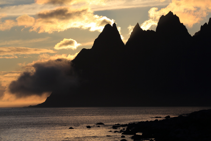
Midnight sun backlights clouds hugging headland below rocky crags of Devil’s Teeth along National Tourist Route on Senja Island, Norway. © Randall Hyman

VIDEO: Cod fishing in the Barents Sea

July 3, 2013

While I have reported on fisheries and dramatic changes in the Barents Sea in some of my other postings, a picture’s worth a thousand words, so I’ll let the video do the talking! (see other videos by clicking the VIDEO CLIPS tab in the banner at the top of this page)

Click on photo here to hop aboard a Russian trawler:

6P5A4583

Catch of cod and redfish aboard Russian trawler off Bear Island. © Randall Hyman

PHOTO GALLERY: Climate change review

June 18, 2013

Seven years ago, the Wall Street Journal ran a front page article datelined Greenland, July 18th, celebrating the warming Arctic climate in terms of increased food production and a steadily lengthening growing season. Retreating glaciers were creating new reindeer pastures, dairy farms were expanding, potatoes were becoming more abundant and farmers were planting broccoli. The reporter suggested that Greenlanders might one day harvest strawberries and apples, weaning the island of dependence on food imports. What was next, I wondered, bananas?

At the halfway point of my Fulbright project, I must, out of fairness, ask myself: is there a good side to climate change? After two months of travel and reporting, I have discovered that climate change has improved the economic outlook for the once-moribund Arctic coast of extreme northern Norway. As the petroleum industry drills ever farther northward, towns like Hammerfest, Honningsvåg and Kirkenes are reviving.

Meanwhile, fishing villages have new hope as cod becomes more abundant due to warmer Atlantic currents drifting northward and bringing with them an upwelling of deep water nutrients. Ports like Longyearbyen are expanding to accommodate increased cruise line traffic as cargo vessels and tourists chase disappearing sea ice to higher latitudes. Foreign companies are scrambling for seabed mineral rights, once locked under the Arctic Ocean’s frozen surface.


Oil rig sits in open waters of Barents Sea in region of Bear Island; Svalbard, Norway. © Randall Hyman

It seems a rosy picture… unless you are a polar bear, or a ringed seal, or even a farmer. Humans pour 80 million tons of carbon dioxide into the air each day. The oceans absorb one-third of that astonishing figure, producing carbonic acid which acidifies the water and strangles marine life. The other two-thirds clog our air and warm our planet. And while shifting entire climate zones northward may help fishermen or farmers in the Arctic, what happens to fisheries and crops at the southern end of the range when rain and temperature patterns are disrupted?

Last month, on May 9, 2013, instruments atop Hawaii’s Mauna Loa recorded over 400ppm (parts per million) of carbon dioxide in the atmosphere, confirming similar readings in March at Svalbard’s Ny-Ålesund weather station. Scientists consider this a critical tipping point bound to raise global temps at least two degrees Celsius. Before the Industrial Age, levels were below 280ppm, and the last time they hit 400ppm was 3 million years ago when camels lived in the high Arctic and seas were 30 feet higher.

During a similar warming period in the 11th through 14th centuries, Norsemen thrived along Greenland’s southern shores, but bubbles of air trapped in glaciers from that time reveal that atmospheric carbon dioxide was far lower. Whatever caused warming back then does not exist now beside our man-made conditions, or New Yorkers would commute to work on jet skis instead of subway trains. While there’s no telling what caused last year’s historic drought in the US, Superstorm Sandy or this summer’s 400-year floods across Central Europe, one still wonders what’s so bad about cleaning up our air and water, and what’s so great about going bananas in Greenland.

WHO CARES ABOUT CLIMATE CHANGE? (click below to find out):

IMG_0381

Young Svalbard reindeer. © Randall Hyman
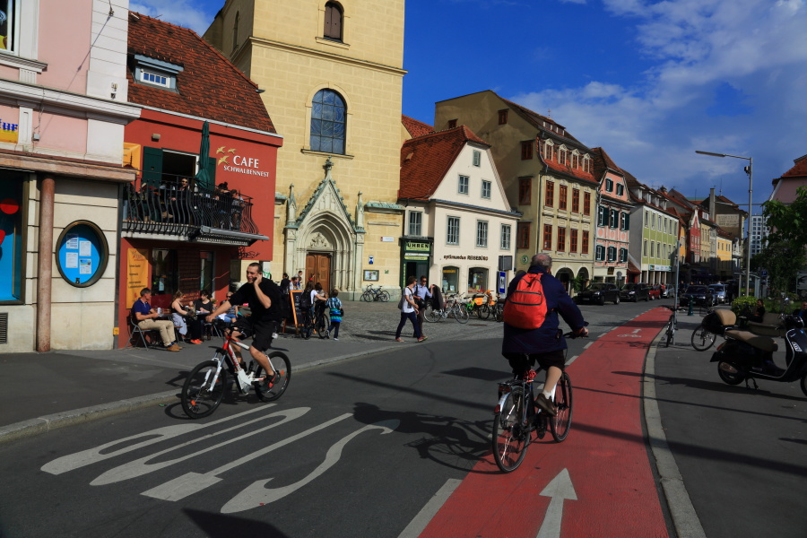
PHOTO GALLERY: Austrian detour

June 12, 2013

Just back in Norway from Austria, where I was invited by the Karl Franzens-University of Graz through the Fulbright Intercountry Lecturer Program as a speaker and panelist at a two-day symposium called, “Visual Cultures: From the Local to the Global.” Co-sponsored by the Departments of American Studies, Cultural Anthropology and History, the symposium explored the power of symbols and imagery in society. My topic was the Lewis and Clark Expedition, which I retraced several years ago from St. Louis to the Pacific Ocean for American History Magazine, and my focus was the role of the photojournalist in shaping cultural mythologies.

Though the adventures of Lewis and Clark in the Great West are a far cry from my own travels in the Great North, my mission here is much the same as it was there. In both cases I was driven to give voice to the unheard. There I explored the Native American point of view, while here I hope to give wildlife, oceans, fishermen and native peoples a fair hearing.

The stakes are high here in the Arctic.  Just this week, the Financial Times front page (Monday, June 10th) announced a deal between Iceland and the Chinese to drill for oil near the island of Jan Mayen– Norwegian territory and a potential political time bomb.  In the words of Heiðar Már Guðjónsson, chairman of the Icelandic partner company, Eykon, “It’s not just oil and gas.  There are minerals, there are potential new shipping routes.”

If anyone doubts the Arctic is undergoing rapid change, think again. Temperature rise here is twice as fast as the global average, and with it grows industrial activity.  While a sizeable population experiences climate change on a daily basis in the Arctic counties of Finnmark and Troms, Norway also has more wealth and environmental fortitude than any other nation in the circumpolar north to deal with it.  The Norwegian Arctic may be the world’s best test case of how to manage climate change, from the local to the global.

CLICK HERE FOR AN AUSTRIAN GETAWAY WEEKEND:

6P5A8379

Graz, Austria. © Randall Hyman

PHOTO GALLERY: Tromsø city life, ducks and geopolitics

May 29, 2013

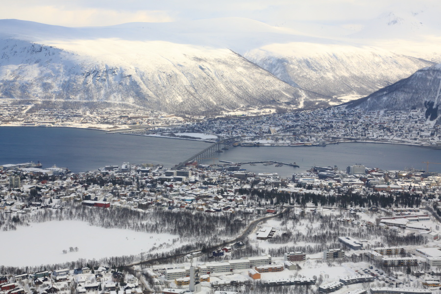
After six weeks of solid travel, I have arrived in Tromsø, a town bustling with shops, restaurants and cultural activities– and headquarters of my host institution, the Norwegian Polar Institute. Reporting since mid April from a remote science base, a coast guard ship and small fishing villages, I feel like I’m in a big city– and by Norwegian standards I am.

As Norway’s seventh-largest city, Tromsø boasts a whopping population of 70,000. For many Norwegians, the far north is culturally and geographically a separate world from the south, narrowing to as little as 10 miles (16 kilometers) from coast to border (Sweden) near the town of Narvik . This is the far north’s appeal– a vast, forgotten land of rugged mountains, endless tundra and jagged coast begging to be explored. Just two counties comprise the stretch from Tromsø to the Russian border, with the largest, Finnmark, twice the size of Vermont and less than two people per square kilometer.

Even in Tromsø, unspoiled nature is just minutes away. Sveinn Are Hanssen, an evolutionary biologist with the Norwegian Institute for Nature Research, has been studying the eider duck colony on nearby Grindøya Island for nearly 20 years, zipping across a short stretch of sea in a skiff every other day each spring. As we approach the island, a gull fearlessly dives on a huge white-tailed eagle as flocks of male eiders in tuxedo plumage eagerly crowd lone females swimming offshore. We are worlds apart from the city.


Male eiders (Somateria mollissima) crowd around lone female along shore of Troms County near Tromso, Norway. © Randall Hyman

“It started out as a theoretical study on a large population that was conveniently nearby,” says Hanssen, “but nests have dropped from 1000 to 150 and now breeding success and blood sampling is practical data we can apply to other Arctic animals, including polar bears.” Because females fast 23 days during nesting, residual pollutants like PCBs that are normally trapped in body fat are released into the blood, weakening hormonal and immune systems. Lactating polar bears endure similar stress after hibernation, so Hanssen also tracks an eider colony in Svalbard each summer.

Connecting such data with the big picture has become increasingly urgent as Norway’s far north experiences dramatic shifts in weather and human activity. Tromsø-based Barents Watch is emerging as a key tool toward this end, pooling heretofore scattered data on fisheries, climate, ship traffic and industrial development in one central data bank that instantly generates intricate, layered maps in endless combinations– easily accessible at www.barentswatch.no. “We celebrate our first birthday this week,” says regional director Frode Kjersem. “Norway wants to develop the Arctic Ocean and Barents and Norwegian Seas, and we want to show the world that we are in control of these waters.”

CLICK PHOTO TO SEE CITY, COAST AND BIRDS:

Tromsø, Norway. © Randall Hyman

PHOTO GALLERY: Kirkenes borderlands

May 27, 2013

It all ends here. And it all starts here– with mind-blowing facts and historical contradictions. Norway’s Russian border is defined largely by one river, Grense Jakobselv, near the town of Kirkenes. Likewise the island town of Vardø sits at the end of a peninsula protruding far above Russia in the Barents Sea, farther east than every single capital in Europe. All of Sweden, most of Finland, all of the Baltic nations (and even St. Petersburg!) lie west of this longitude. While there are tensions along the border, this is the only land the Red Army ever invaded and then retreated from without keeping any territory. And so begin the contradictions.

At the frontier of one of the most peaceful nations on Earth, cradle of the Nobel Peace Prize, the border is festooned with guard towers, warning signs and surveillance cameras, yet a statue of a Russian soldier commands a hilltop in the middle of Kirkenes with a plaque thanking the Red Army for liberation from the Nazis (and from Finland, an Axis ally). Vital to the German attacks on Allied naval convoys supplying Russian troops, Kirkenes shares with Dresden the distinction of the most frequently bombed city in WWII, courtesy of the USSR. Now a staunch NATO ally, Norway hosts an expansive radar installation at Vardø which the West claims is a space junk tracking station, but which Russia angrily denounces as an early warning system.

Nation’s easternmost town is dominated by radar domes and historic star fort equipped with old and new cannons overlooking maritime Russian border; Vardo, Norway. © Randall Hyman

No stranger to militarization, Vardø also boasts a star fortress which Denmark built in the mid 1700s. It is now purely ceremonial, but is especially popular each year when the sun first returns after winter’s long darkness and two cannons are fired to signal a day off of school. On the mainland sits another vestige of occupation,  a sturdy stone church King Oscar of Sweden erected in 1869 at the mouth of Grense Jakobselv, firmly rooted in bedrock of  Norway’s oldest mountains, tagged at 3 billion years.

Long at the crossroads of invasions, occupations and retreats, this part of Norway has its own personality, formed by Finnish Samis, Russians, and dozens of other nationalities that feel at home in this occasional no-man’s land– resulting in an alluring mix of racial features in the faces of the local population. International politics aside, Norwegians and Russians have a surprising tradition of friendship. Even during the deep freeze of the Cold War, they cooperated in building five hydroelectric power plants along the border. Fittingly, the fishing grounds that lie between their nations deep in the Barents Sea are jointly controlled and known as the Gray Zone, somewhat blurring the line that defines the end, and start, of Norway’s Arctic waters.

CLICK PHOTO TO EXPLORE THE FRONTIER:

Girls’ faces show mix of Sami and Norse ancestries common in Kirkenes, Norway. © Randall Hyman

PHOTO GALLERY: Hip hooray for 17th of May

May 21, 2013

“Hip hurra for syttende mai!,” is the cheer heard throughout Norway on this day, the equivalent of America’s July 4th. It is National Day, and Norwegians celebrate their 1814 constitution in grand style.  No military bombast and no fireworks, just parades, flags, national costumes (bunads) and endless ice cream and cake. It is a day for kids, including high school seniors (aka “Russ”), who end their two-week-plus graduation celebration today before taking final exams.

In tiny Kirkenes, where the West ends and the Russian bear casts its long shadow along a 195-kilometer border, independence and freedom are keenly felt. Three children at the local grammar school deliver a speech in Norwegian, Russian and Sami, extolling the importance of dialog, not guns, to protect Norway’s abundant blessings. Russian artistic director, Luba Kuzovnikova, who runs the annual arts festival, gives a keynote speech in town square jokingly declaring herself a member of the Barents Liberation Army, reflecting local concerns that outside oil and mining interests may soon call the shots.

“Of course we realize that oil and gas must be developed,” she tells me afterwards, “but there should be a balance.” Thanks to the 1993 Euro-Arctic Barents Region agreement between Norway, Russia, Finland and Sweden, hundreds of regional projects have hatched in the past 20 years without the interference of federal bureaucracies, but this may change as the Russian bear grows restive and multinational companies step in.

It’s all fun and games today, though. Children fill their bellies with sweets and admiringly chase after Russ students to collect the personalized photo cards they carry with slogans that range from sassy to risqué. National Day is bittersweet for high school seniors, with a carefree existence coming to an end. Norway is egalitarian in terms of salaries, but the educational system is rigidly split. Red-pants Russ go to liberal arts universities, black pants go to vocational college and two-year apprenticeships in their chosen trades. Red or black pants, white or blue collar, everyone is Norwegian today.

CLICK PHOTO TO JOIN THE PARADE:

Celebrants wave Norwegian flags during 17th of May parade in Kirkenes, Norway. © Randall Hyman

PHOTO GALLERY: Honningsvåg’s rites of passage

May 15, 2013

From the moment I arrive in Honningsvåg, I see this is a visit about passages. I already have lots of landscape pictures of North Cape, northernmost point in Europe, but this visit is about people, the community, and huge changes ahead. I am greeted by a group of high school girls, full of life and mischief, standing in the middle of the main street, music blaring, whistles blowing, jumping about in bright red pants with the letters “Russ” written down their legs. It is the 17-day high school graduation celebration, aka Russ, with wild antics and parties leading up to a finale on National Day, May 17th.

Unfortunately, it is also the week BEFORE, not after, exams! With great wealth and seismic changes in the cultural landscape, the celebration is increasingly a venue for binge drinking, promiscuity and lavish spending on custom-painted, sound-rigged party vans and even buses. It looks innocent, and in small towns it generally is, with a list of pranks that earn knots tied onto the Russ cap tassle for each success, ranging from kissing a teacher to going 17 days without changing pants. Adults look the other way, figuring this is a final blast before more serious life begins.

At the other end of the innocence spectrum come confirmations this same week, with 14-year-olds and their relatives filling churches and banquet halls in white gowns and bunads, the national costume, which are distinct in design and decoration for each region. At a cost of $5000 each, bunads are bestowed upon confirmants to last a lifetime.

A few days later, the older generation has its day at a coffeehouse party presented by Perleporten, the town’s new culture house. Musicians perform songs from yesteryear and a local movie director tells funny tales of his life making films. No one wants it to end. One elderly woman, with tears in her eyes, tells owner Birgit Johansen, “This was my best day in years.”

Each age has its rite of passage this week, all against the backdrop of a major announcement in February that oil discovered offshore will will be pumped to an enormous storage facility to be built outside town in underground reservoirs blasted out of solid rock, bringing unimaginable wealth. “Up till now we’ve been based on fishing and tourism,” muses Hans Hansen, regional marketing director for Rica Hotels, “but this society is going to go through tremendous changes.”

CLICK PHOTO FOR PASSAGE:

High school girls pose in their red Russ pants in Honningsvåg, Norway. © Randall Hyman


error: Content is protected !!